This research has focused its attention on study areas that are mainly located in Spain, but it also has an comparative international dimension through fieldwork conducted in Greece, Portugal, the United Kingdom and Australia.
The reasons for choosing to conduct this fieldwork in these particular territories include the presence of the following common characteristics: (1) the study areas include protected coastal wetlands and/or rivers; (2) they have a variety of rural and semi-rural locations and small towns; (3) they have a significant immigrant population that has increased in recent decades; (4) the tourism and agriculture sectors form a major part of the economy; (5) the study areas are relatively far away from any major cities.
The specific study areas are briefly introduced below (in the 'main results' section some pictures are shown):
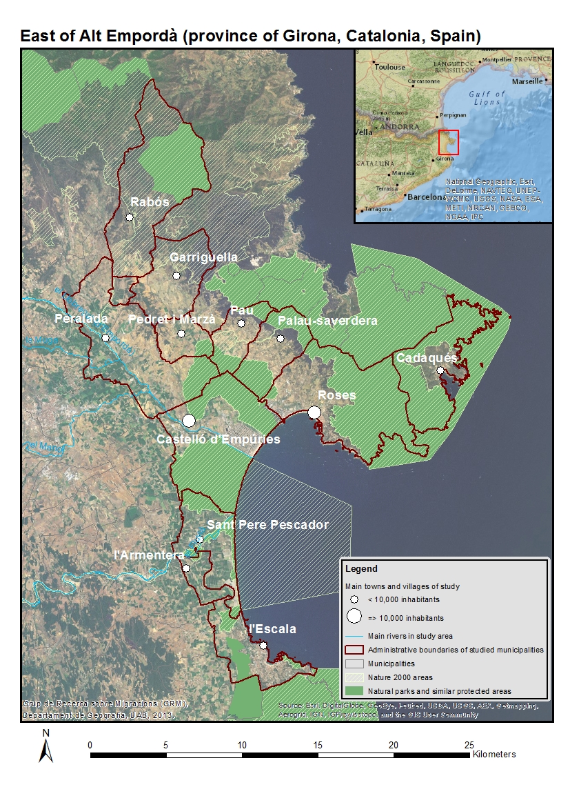
1) East of Alt Empordà county (province of Girona, Catalonia, Spain).
The border between Spain and France marks the northern boundary of this county in the northeast of the Iberian Peninsula, which contains numerous natural parks including the Parc Natural del Cap de Creus, the Parc Natural dels Aiguamolls de l' Empordà and the Paratge Natural d'Interès Nacional de l'Albera. The study has focused on the area close to these natural spaces, such as the small towns of Roses and Castelló d’Empúries, as well as other towns in the area such as l’Armentera, Cadaqués, l’Escala, Garriguella, Palau-Saverdera, Pau, Rabós and Sant Pere Pescador. All of these are located in the most easterly half of the aforesaid county of Alt Empordà, the region closest to the Mediterranean Sea. The tourism sector is extremely important in this study area, but at the same time, the primary sector also plays a relatively important role (in order to explore some specific issues, fieldwork was also carried out in the French side of Albera). The populations of these towns generally include a higher percentage of foreign residents than the averages for Spain and Catalonia. (click on the map below)
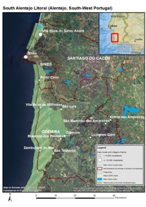
2) Alentejo Litoral (Alentejo, South-West Portugal).
The main focus in Portugal has been on the concelho of Odemira. This municipality is located on the southwest coast of Portugal, and is the biggest in the country while also being one of the least densely populated. The concelho de Odemira is divided into 17 freguesias (a smaller administrative region than a municipality). One of the characteristics of the concelho is the wide variety of its landscapes and socio-economic conditions that make its coastal, central and most inland regions highly distinguishable from each other. The former has a major presence of intensive agriculture along with a relatively important tourism sector. Most of the Parque Natural do Sudoeste Alentejano e Costa Vicentina is in this region. The second contains the largest population nucleuses and the main services. While the third has more mountainous terrain, it is also the one that has suffered the most extreme depopulation processes and the one with the greatest presence of more traditional forms of agriculture. The percentages of foreign residents in Odemira are generally higher than the averages for Portugal and Alentejo. In order to explore some specific isues, fieldwork was also carried out in other concelhos of Alentejo Litoral such as Sines and Santiago do Cacém. (click on the map below)
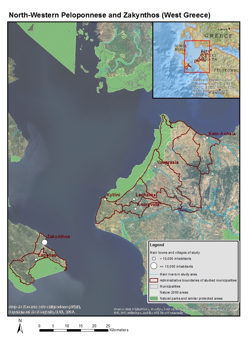
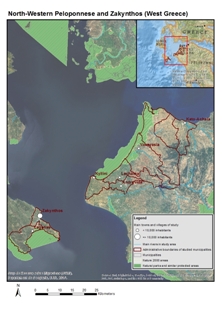
3) Northwest Peloponnese and Zakynthos (Western Greece, Greece).
The main municipalities of study are the Peloponnesian towns of Andravida-Kyllini and Kato-Achaia, and to a lesser extent the nearby island of Zakynthos. All of these belong to the Greek region of Western Greece. The protected natural areas of Kotychi-Strofylia are in the northeast of the Peloponnese Peninsula between Andravida-Kyllini and Kato Achaia (both with economies dedicated to intensive agriculture as well as, to differing extents, tourism), while the highly touristic island of Zakynthos also has some protected natural areas such as one that is home to a highly emblematic species of turtle. The percentages of foreign residents in these Greek towns are also very high. For example, they include the town of Manolada (municipality of Andravida-Kyllini) that in recent years has often appeared in the national and international press due to the racist attacks on immigrants of Asian origin, although it has been the scene of expressions of solidarity. (click on the map below)
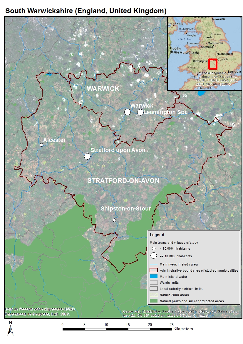
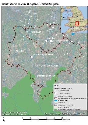
4) South Warwickshire (England, United Kingdom).
The English study area is the south of Warwickshire (West Midlands), which among other places includes the small town of Stratford upon Avon, our focus of attention. The most important economic sectors in Stratford upon Avon are tourism and, in close relation to this, trade. The name ‘Stratford’ comes from the Old English strǣt, meaning ‘street’, in reference to an ancient Roman road, and the ford that crossed the River Avon (in some Celtic languages, including Welsh, ‘Afon’ is the word for river). For many centuries, Stratford upon Avon has been a human settlement connected to other places and people by land and waterway. As far as tourism is concerned, Stratford upon Avon attracts visitors from all over the world, mainly because the town was the birthplace of William Shakespeare. Apart from its many cultural attractions, the area also includes several protected natural spaces, while the agricultural sector is also relatively important. In recent years, as well as immigration from North America and the countries of the Commonwealth, new immigrants from Poland and other countries of Central and Eastern Europe have settled in and around Stratford-upon-Avon. (click on the map below)
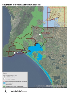
5) Southeast of South Australia (Australia).
The territory being studied in South Australia is that of the lower section of the River Murray, Lake Alexandrina and Encounter Bay, and includes three different Local Government Areas (LGA) located along the northeast-southwest axis: Murray Bridge (considered a Rural City), Alexandrina (considered a District Council) and Victor Harbor (considered a City Council). All three of these place-names are associated to water.
The geographical identity of the first and second are directly related with the River Murray and Lake Alexandrina respectively (this river flows through the aforesaid lake towards its estuary). Meanwhile, the geographical identity of Victor Harbor LGA is mainly associated to Encounter Bay. This is the bay where the Murray Estuary reaches the Antarctic Ocean. From some parts of Victor Harbor the Murray Estuary can be seen with the naked eye and several sea routes connect the town with the Coorong, a nationally and internationally protected natural space, especially because of its birdlife. (click on the map below). The study area’s economy is largely based on tourism and agriculture. The percentages of both domestic and international immigrants in these Australian towns are also fairly high (although not as high as those in the case studies in Southern Europe), especially when compared with non-metropolitan areas further inland in Australia. In order to explore some specific isues, fieldwork was also carried out in other South Australian localities with recent immigration such as Naracoorte and Mount Gambier.
|